 |
| Delicate Arch - Arches National Park I recently completed a road trip from Boulder, Colorado to El Paso, Texas and back. I decided to take the scenic route that took me to; Arches National Park, a couple of National Monuments, and some Arizona slot canyons. This blog will show you a good sample of the pictures I took along the way. |
 |
| Turret Arch framed by the North Window Arch. Look closely and you will see two young ladies standing in Window Arch. |
 |
| Landscape Arch - Unfortunately you can no longer walk under this arch. A piece of the arch fell of a few years ago so the area is fenced off. |
 |
| The Marching Men can be seen in the background of this photo. This is the trail to Tower Arch in the northwestern part of Arches National Park. |
 | ||||
Corona Arch - After a few days of hiking with the crowds in Arches National Park I decided to get out of the park and hike to Corona Arch and Fisher Towers.
|


 |
| Fallen Roof Ruin is in Road Canyon - This ruin is a little more challenging to find. I stopped in the ranger station to get a little help. But the only advice I got was "the road is impassible if it rains and it looks like rain." After capturing this shot I was returning to my car when I ran into another hiker who had been wandering the canyon for two hours looking for the ruin. |
 |
| Natural Bridges National Monument is very close to both Mule and Road Canyon. There are three large natural bridges in the monument. This is a picture of Sipapu Bridge. To get a good perspective of the sizes of these bridges you need to hike to the bottom of the canyon. You drop about 500 feet with a couple of log ladders along the way. |
 |
| I hiked the loop hike from Sipapu Bridge to Kachina Bridge. Along the canyon bottom I found this large blooming cactus. |
 | ||||||
Kachina Bridge - After walking to House on Fire, Fallen Roof Ruin, and the loop hike to the two natural bridges I was ready to find my hotel and a good place for dinner.
|


 |
| Another perspective of Castle Butte |
 |
| Valley of Gods - I thought the tree was an interesting subject and tried many compositions. |
 |
| The Goosenecks State Park - Not far from the west end of the Valley of the Gods are the goosenecks of the San Juan River. In a distance of one mile the San Juan River travels six miles as it winds back and forth. |
 | ||||||
Hovenweep National Monument was the next stop on the road trip. Round, D-shaped, and square towers were built at this site.
|


 |
| Last cloud picture. As I headed back to Bluff Utah it looked like the sky might light up so I drove an additional 45 miles to reach Monument Valley. |
 |
| Unfortunately the sunset over Monument Valley did not live up to my expectations. So it was back to Bluff for bedtime. |
 |
| The next morning I headed to Page, Arizona. I stopped at Navajo National Monument to checkout Betatakin, an Ancestral Puebloans ruin. Over a 100 people lived at this site. |
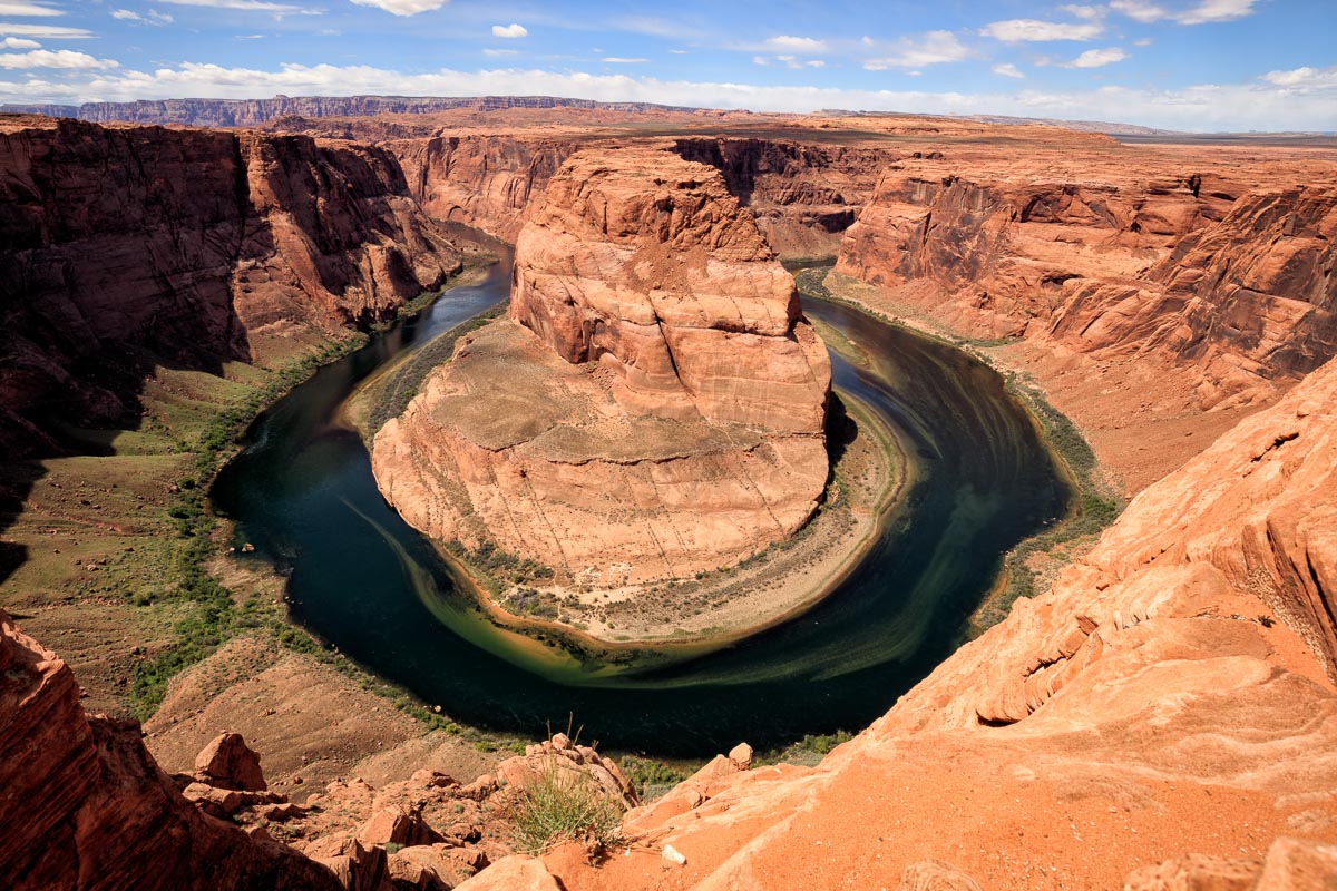 |
| After a quick lunch in Page I headed out to Horseshoe Bend. The trail to this location is about 8 feet wide and you will share it with about 300 people. |
 |
| The fort at Lee's Ferry. The ferry was one of the few locations where early Arizona settlers could cross the Colorado River. |
 |
| Balanced rock near Lee's Ferry. My Expedition is in the background. |
 |
| The original Navajo Bridge and it's replacement. In 1929 the Navajo Bridge on the left was built to replace Lee's Ferry. The ferry was used to haul some of the bridge parts across the Colorado. The was a California Condor resting on one of the bridges. |
 | ||
The next morning I went on a photo tour of Cottonwood and Upper Antelope Slot Canyons. Unfortunately you can no longer take photo tours of Lower Antelope Canyon.
|

 |
| Tumbleweed in Cottonwood Canyon |
 |
| Nice colors in Cottonwood. |
 |
| We walked through this little arch. |
 |
| Upper Antelope Canyon. We shared this canyon with 750 people. There were four photo tour groups here at the same time. Everyone wanted to capture the same light beams at the same time. |
 |
| A tour group was asked to hold around the corner so we could capture this shot. |
 |
| As you look up toward the top of the slot canyon the colors get lighter making for interesting compositions. |
 |
| My favorite picture from Upper Antelope Canyon |
 |
| All of the tour guides are throwing sand into the air so people can capture light beam pictures and falling sand pictures. Therefore the canyon is quite dusty. The guides are either wearing bandannas or dust mask. Wish I had one. |
 |
| One of many light beam pictures. I was standing in a line of 25 photographers. We had two minutes to get this shot so another group could get the shot. |
 |
| At the top of this picture you can see some flood debris. This material is about 15 feet above the floor. A good reason not to be in slot canyons on a raining day. |
 |
| That's all for this road trip. Hope you enjoyed the pictures. |